


Popular GPS Units for Commercial Use
The Global Positioning System (GPS) has been pivotal in revolutionizing people’s personal and professional lives. In the United States alone, there were close to 9.61 million people who claim to have used maps and GPS navigation from the autumn of 2009 to the autumn of 2012. Statistics also point out that the total equipment for GPS sales amounted to 69.82 million units in 2005 alone and increased to 122.35 million units by 2010. GPS will essentially determine your exact position on the planet for free. Popularly used in cars, these devices will also serve as handy tools in the professional world with an array of tasks being performed more easily, accurately and quickly than before. Here is a look at the popular professional GPS units that are most useful for various commercial businesses.
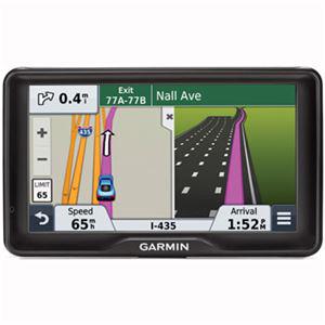
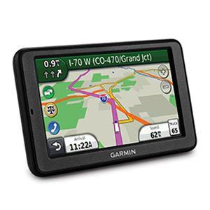
For Trucking
While most people will believe that GPS in trucks will be similar to the ones in cars, they are actually quite different. The primary reason for the difference is that several roads in the US are restricted to trucks and trailers alone. A professional GPS unit that is designed for the trucking industry comes pre-programmed with the elimination of thousands of miles of roads that are not accessible to trucks. Moreover, the navigation system of a truck needs to consider different speed limits, clear information and weight limits.
In the Air
The aviation industry should benefit from professional GPS units across all commercial airlines and private planes, especially given the recent airline mishaps. The additional special functions of this navigational system include airspace and altitude calculations,flight planning, critical alerts, airport and runway information collection, and more. The altitude positioning will only be possible after with the presence of extra satellites that support 3D positioning. This function will also come integrated with the auto pilot mode on most aircraft.
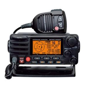
At Sea
Nautical tracking units are already in use but are only restricted to two dimensions. Recently, there has been the entry of 3D navigation technology in mariners, similar to those for airplanes. This extra dimension will allow navigators to make note of areas with low or shallow depths. It can help in locating ice burgs, and keep the vessel away from shallow waters. Just like the traditional 2D system in cars points out special places to eat and shop, the marine navigation system will pin point areas of interest, including waterfalls, rapids, fishing areas, islands, etc. This can allow the captain of a vessel to plan the fastest and safest route to a destination much more efficiently.
